
Sommersdorf topographic map
Interactive map
Click on the map to display elevation.
About this map
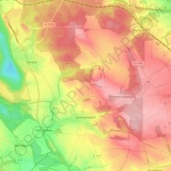
Name: Sommersdorf topographic map, elevation, terrain.
Location: Sommersdorf, Obere Aller, Börde, Saxony-Anhalt, Germany (52.14607 11.05178 52.21140 11.14712)
Average elevation: 158 m
Minimum elevation: 65 m
Maximum elevation: 216 m