
Luvos topographic map
Interactive map
Click on the map to display elevation.
About this map
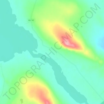
Name: Luvos topographic map, elevation, terrain.
Location: Luvos, Jokkmokk, Norrbotten County, Region Norrland, Sweden (66.63140 18.82404 66.67140 18.86404)
Average elevation: 433 m
Minimum elevation: 402 m
Maximum elevation: 523 m