
Oviedo topographic map
Interactive map
Click on the map to display elevation.
About this map
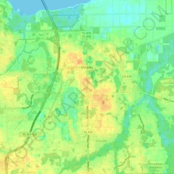
Name: Oviedo topographic map, elevation, terrain.
Location: Oviedo, Seminole County, Florida, 32765, United States (28.62670 -81.24183 28.69212 -81.13402)
Average elevation: 14 m
Minimum elevation: -2 m
Maximum elevation: 30 m
Other topographic maps
Click on a map to view its topography, its elevation and its terrain.