
Castelmartini topographic map
Interactive map
Click on the map to display elevation.
About this map
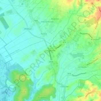
Name: Castelmartini topographic map, elevation, terrain.
Location: Castelmartini, PT, Tuscany, 51036, Italy (43.80312 10.82041 43.84312 10.86041)
Average elevation: 24 m
Minimum elevation: 10 m
Maximum elevation: 53 m