
Hausruck topographic map
Interactive map
Click on the map to display elevation.
About this map
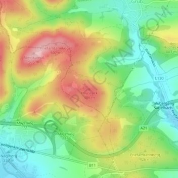
Name: Hausruck topographic map, elevation, terrain.
Average elevation: 397 m
Minimum elevation: 317 m
Maximum elevation: 503 m
Other topographic maps
Click on a map to view its topography, its elevation and its terrain.
Sulz im Wienerwald
Austria > Lower Austria > Bezirk Mödling > Gemeinde Wienerwald
Sulz im Wienerwald, Gemeinde Wienerwald, Bezirk Mödling, Lower Austria, 2392, Austria
Average elevation: 459 m