
Dhargaon topographic map
Interactive map
Click on the map to display elevation.
About this map
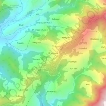
Name: Dhargaon topographic map, elevation, terrain.
Location: Dhargaon, Kotdwara, Pauri Garhwal, Uttarakhand, India (29.84907 78.63003 29.88907 78.67003)
Average elevation: 1,218 m
Minimum elevation: 911 m
Maximum elevation: 1,762 m