
Horseshoe Bay topographic map
Interactive map
Click on the map to display elevation.
About this map
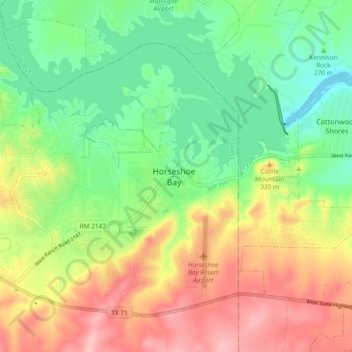
Name: Horseshoe Bay topographic map, elevation, terrain.
Location: Horseshoe Bay, Llano County, Texas, 78657, USA (30.50429 -98.40641 30.58429 -98.32641)
Average elevation: 286 m
Minimum elevation: 224 m
Maximum elevation: 368 m