
Wuhua County topographic map
Interactive map
Click on the map to display elevation.
About this map
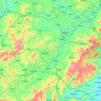
Name: Wuhua County topographic map, elevation, terrain.
Location: Wuhua County, Meizhou, Guangdong Province, China (23.37618 115.31160 24.19390 116.01986)
Average elevation: 301 m
Minimum elevation: 7 m
Maximum elevation: 1,255 m
Other topographic maps
Click on a map to view its topography, its elevation and its terrain.
Meixian District
China > Guangdong Province > Meizhou
Meixian District, Meizhou, Guangdong Province, China
Average elevation: 301 m
Xingning
China > Guangdong Province > Meizhou
Xingning, Meizhou, Guangdong Province, China
Average elevation: 266 m