
Tielt topographic map
Interactive map
Click on the map to display elevation.
About this map
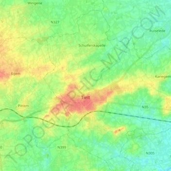
Name: Tielt topographic map, elevation, terrain.
Location: Tielt, West Flanders, Flanders, 8700, Belgium (50.96107 3.28629 51.05387 3.45256)
Average elevation: 24 m
Minimum elevation: 7 m
Maximum elevation: 51 m