
Pierre topographic map
Interactive map
Click on the map to display elevation.
About this map
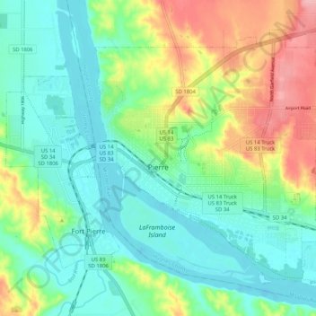
Name: Pierre topographic map, elevation, terrain.
Location: Pierre, Hughes County, South Dakota, 57501, United States (44.34066 -100.37174 44.40032 -100.26921)
Average elevation: 469 m
Minimum elevation: 429 m
Maximum elevation: 556 m