
Maluti-a-Phofung Ward 20 topographic map
Interactive map
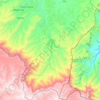
Click on the map to display elevation.
About this map
Name: Maluti-a-Phofung Ward 20 topographic map, elevation, terrain.
Average elevation: 2,228 m
Minimum elevation: 1,400 m
Maximum elevation: 3,290 m
Other topographic maps
Click on a map to view its topography, its elevation and its terrain.
Sentinal Gully
Afrique du Sud > État-Libre > Thabo Mofutsanyana District Municipality > Maluti-a-Phofung Local Municipality
Sentinal Gully, Maluti-a-Phofung Ward 20, Maluti-a-Phofung Local Municipality, Thabo Mofutsanyana District Municipality, État-Libre, Afrique du Sud
Average elevation: 2,669 m