
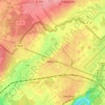
Meyrin topographic map
Interactive map
Click on the map to display elevation.
About this map
Name: Meyrin topographic map, elevation, terrain.
Location: Meyrin, Geneva, Switzerland (46.21717 6.04611 46.24715 6.11190)
Average elevation: 434 m
Minimum elevation: 366 m
Maximum elevation: 478 m
Other topographic maps
Click on a map to view its topography, its elevation and its terrain.
Dardagny Castle
Switzerland > Geneva > Dardagny
Dardagny Castle, 520, Route du Mandement, Dardagny, Geneva, 1283, Switzerland
Average elevation: 431 m
Le Grand-Saconnex
Switzerland > Geneva > Le Grand-Saconnex > Le Grand-Saconnex
Le Grand-Saconnex, Grand Genève, Geneva, 1218, Switzerland
Average elevation: 414 m
Le Grand-Saconnex
Le Grand-Saconnex, Geneva, 1218, Switzerland
Average elevation: 429 m