
Penhold topographic map
Interactive map
Click on the map to display elevation.
About this map
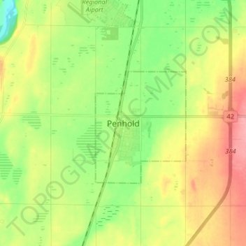
Name: Penhold topographic map, elevation, terrain.
Location: Penhold, Town of Penhold, Alberta, T0M 1R0, Canada (52.10076 -113.91075 52.18076 -113.83075)
Average elevation: 907 m
Minimum elevation: 867 m
Maximum elevation: 957 m