
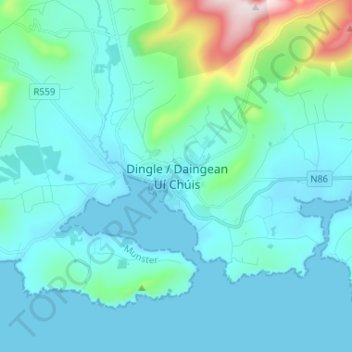
Dingle - Daingean Uí Chúis topographic map
Interactive map
Click on the map to display elevation.
About this map
Name: Dingle - Daingean Uí Chúis topographic map, elevation, terrain.
Location: Dingle - Daingean Uí Chúis, County Kerry, Munster, Irland (52.10084 -10.30888 52.18084 -10.22888)
Average elevation: 77 m
Minimum elevation: 0 m
Maximum elevation: 604 m