
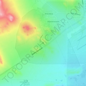
Edwards Air Force Base topographic map
Interactive map
Click on the map to display elevation.
About this map
Name: Edwards Air Force Base topographic map, elevation, terrain.
Average elevation: 730 m
Minimum elevation: 694 m
Maximum elevation: 828 m
Ground tests began five days after the first XP-59 arrived on 21 September 1942. First flight took place on 30 September when the XP-59 rose to 10 feet (3.0 m) altitude for 0.5 miles (0.80 km) during taxi testing. However, the first official flight was 1 October 1942 with NACA, Navy Bureau of Aeronautics, Royal Air Force, Army, Bell and General Electric personnel on hand.
Other topographic maps
Click on a map to view its topography, its elevation and its terrain.
Tehachapi
United States > California > Kern County
Tehachapi, Kern County, California, 93561, United States
Average elevation: 1,414 m
Mojave
United States > California > Kern County
Mojave, Kern County, California, United States
Average elevation: 857 m
Wasco
United States > California > Kern County
Wasco, Kern County, California, United States
Average elevation: 101 m
Cantil
United States > California > Kern County
Cantil, Kern County, California, United States
Average elevation: 628 m
Woodford
United States > California > Kern County
Woodford, El Rita, Kern County, California, 93531, United States
Average elevation: 899 m
City of Shafter
United States > California > Kern County
City of Shafter, Kern County, California, United States
Average elevation: 118 m
Tehachapi Mountain
United States > California > Kern County
Tehachapi Mountain, Kern County, California, United States
Average elevation: 2,142 m
Rosamond
United States > California > Kern County
Rosamond, Kern County, California, 93560, United States
Average elevation: 749 m
Baker
United States > California > Kern County > Boron
Baker, Boron, Kern County, California, United States
Average elevation: 765 m
Gulf
United States > California > Kern County
Gulf, Kern County, CAL Fire Contract Counties, California, United States
Average elevation: 88 m
Kern City
United States > California > Kern County > Bakersfield
Kern City, Bakersfield, Kern County, CAL Fire Southern Region, California, 93309, United States
Average elevation: 119 m
Golden Hills
United States > California > Kern County > Golden Hills
Golden Hills, Kern County, California, United States
Average elevation: 1,275 m
Onyx
United States > California > Kern County
Onyx, Kern County, California, 93255, United States
Average elevation: 1,205 m
Arvin
United States > California > Kern County
Arvin, Kern County, California, United States
Average elevation: 130 m
California City
United States > California > Kern County
California City, Kern County, California, United States
Average elevation: 845 m
Buttonwillow
United States > California > Kern County > Buttonwillow
Buttonwillow, Kern County, California, 93206, United States
Average elevation: 87 m
Rosedale
United States > California > Kern County
Rosedale, Kern County, CAL Fire Southern Region, California, United States
Average elevation: 107 m
Frazier Park
United States > California > Kern County
Frazier Park, Kern County, California, United States
Average elevation: 1,533 m
Oil City
United States > California > Kern County
Oil City, Kern River Oil Field, Kern County, California, 93305, United States
Average elevation: 162 m
Walong
United States > California > Kern County > Keene
Walong, Keene, Kern County, California, United States
Average elevation: 998 m
McKittrick
United States > California > Kern County
McKittrick, Kern County, California, 93251, United States
Average elevation: 388 m
Taft
United States > California > Kern County > Taft > Taft
Taft, Kern County, California, 93268, United States
Average elevation: 301 m
China Lake
United States > California > Kern County > Ridgecrest > China Lake
China Lake, Ridgecrest, Kern County, California, 93555-2508, United States
Average elevation: 689 m
Goler Heights
United States > California > Kern County > Goler Heights
Goler Heights, Kern County, California, United States
Average elevation: 822 m
Edison
United States > California > Kern County
Edison, Kern County, California, 93303, United States
Average elevation: 178 m
Taft
United States > California > Kern County
Taft, Kern County, California, 93268, United States
Average elevation: 370 m
Pine Mountain Club
United States > California > Kern County
Pine Mountain Club, Kern County, California, 93222, United States
Average elevation: 1,867 m
Rowen
United States > California > Kern County
Rowen, Kern County, California, 93531, United States
Average elevation: 806 m
Bakersfield
United States > California > Kern County
Bakersfield, Kern County, California, United States
Average elevation: 157 m
Lebec
United States > California > Kern County
Lebec, Kern County, California, 93243, United States
Average elevation: 1,162 m
Rosedale
United States > California > Kern County
Rosedale, Kern County, California, United States
Average elevation: 113 m
Inyokern
United States > California > Kern County > Inyokern
Inyokern, Kern County, California, United States
Average elevation: 753 m
Kernville
United States > California > Kern County
Kernville, Kern County, California, 93238, United States
Average elevation: 1,135 m