
Lac Croche topographic map
Interactive map
Click on the map to display elevation.
About this map
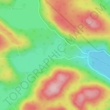
Name: Lac Croche topographic map, elevation, terrain.
Average elevation: 418 m
Minimum elevation: 320 m
Maximum elevation: 531 m
Other topographic maps
Click on a map to view its topography, its elevation and its terrain.
Parc régional de la Chute-à-Bull
Canada > Québec > Saint-Côme
Parc régional de la Chute-à-Bull, Sentier de la Chute, Domaine-Lac-France, Saint-Côme, Matawinie, Lanaudière, Québec, Canada
Average elevation: 356 m
Lac Guénard
Canada > Québec > Saint-Côme
Lac Guénard, Rue du Lac Guénard, Saint-Côme, Matawinie, Lanaudière, Québec, Canada
Average elevation: 370 m