
Brye topographic map
Interactive map
Click on the map to display elevation.
About this map
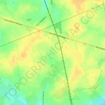
Name: Brye topographic map, elevation, terrain.
Location: Brye, Fleurus, Charleroi, Hainaut, Wallonia, 6222, Belgium (50.51745 4.54231 50.54231 4.58049)
Average elevation: 152 m
Minimum elevation: 134 m
Maximum elevation: 162 m
Other topographic maps
Click on a map to view its topography, its elevation and its terrain.
Forchies-la-Marche
Belgium > Hainaut > Charleroi > Fontaine-l'Évêque
Forchies-la-Marche, Fontaine-l'Évêque, Charleroi, Hainaut, Wallonia, 6141, Belgium
Average elevation: 171 m
Pont-à-Celles
Pont-à-Celles, Charleroi, Hainaut, Wallonia, Belgium
Average elevation: 147 m