
Grafenegg topographic map
Interactive map
Click on the map to display elevation.
About this map
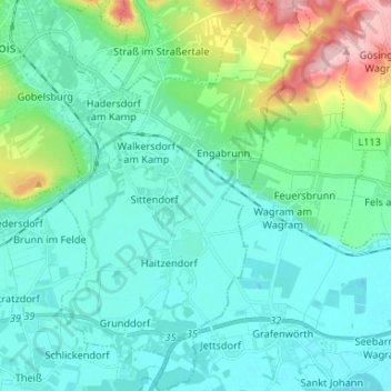
Name: Grafenegg topographic map, elevation, terrain.
Location: Grafenegg, Bezirk Krems, Lower Austria, Austria (48.39586 15.70237 48.48311 15.78577)
Average elevation: 219 m
Minimum elevation: 182 m
Maximum elevation: 373 m