
Firth topographic map
Interactive map
Click on the map to display elevation.
About this map
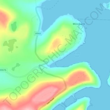
Name: Firth topographic map, elevation, terrain.
Location: Firth, Shetland Islands, Scotland, ZE2 9TL, United Kingdom (60.42910 -1.21860 60.46910 -1.17860)
Average elevation: 34 m
Minimum elevation: -1 m
Maximum elevation: 130 m
Scotland trails, hiking, mountain biking, running and outdoor activities