
Mousa Ali topographic map
Interactive map
Click on the map to display elevation.
About this map
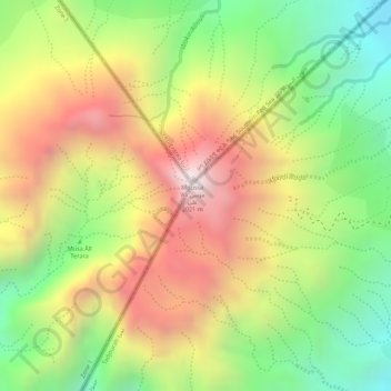
Name: Mousa Ali topographic map, elevation, terrain.
Location: Mousa Ali, Dorra District, Tadjourah, Djibouti (12.46773 42.40442 12.46783 42.40452)
Average elevation: 1,604 m
Minimum elevation: 1,186 m
Maximum elevation: 2,014 m
Other topographic maps
Click on a map to view its topography, its elevation and its terrain.
Ardo أردو
Djibouti > Tadjourah > Randa District > Ardo أردو
Ardo أردو, Randa District, Tadjourah, Djibouti
Average elevation: 797 m
Lake Assal
Lake Assal, Balha, Tadjourah, Djibouti
Average elevation: -133 m