
Châtillon topographic map
Interactive map
Click on the map to display elevation.
About this map
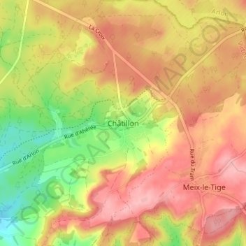
Name: Châtillon topographic map, elevation, terrain.
Location: Châtillon, Virton, Luxembourg, Wallonie, 6747, Belgique (49.60558 5.67836 49.64558 5.71836)
Average elevation: 345 m
Minimum elevation: 272 m
Maximum elevation: 397 m