
Mount Ramelau topographic map
Interactive map
Click on the map to display elevation.
About this map
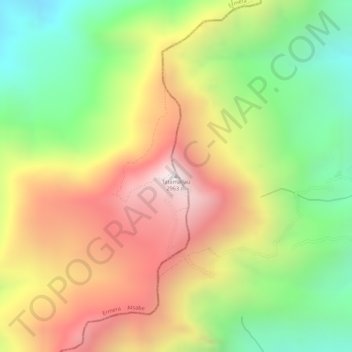
Name: Mount Ramelau topographic map, elevation, terrain.
Location: Mount Ramelau, Ainaro, East Timor (-8.90655 125.49349 -8.90645 125.49359)
Average elevation: 2,486 m
Minimum elevation: 2,027 m
Maximum elevation: 2,935 m
Other topographic maps
Click on a map to view its topography, its elevation and its terrain.