
Austin topographic map
Interactive map
Click on the map to display elevation.
About this map
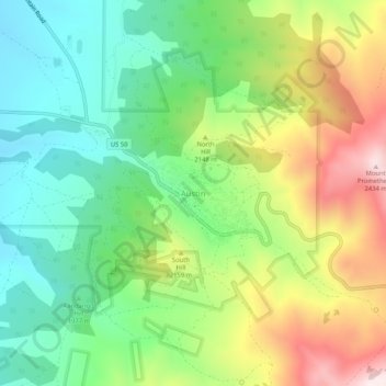
Name: Austin topographic map, elevation, terrain.
Location: Austin, Lander County, Nevada, United States (39.47326 -117.08954 39.51326 -117.04954)
Average elevation: 2,076 m
Minimum elevation: 1,841 m
Maximum elevation: 2,464 m
Austin is an unincorporated small town in, and former county seat of, Lander County, Nevada, United States. In 2020, the census-designated place of Austin had a population of 167. It is located on the western slopes of the Toiyabe Range at an elevation of 6,575 feet (2,004 m). U.S. Route 50 passes through the town.