
Port Campbell Coastal Reserve topographic map
Interactive map
Click on the map to display elevation.
About this map
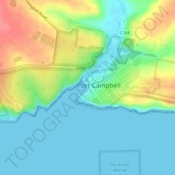
Name: Port Campbell Coastal Reserve topographic map, elevation, terrain.
Average elevation: 25 m
Minimum elevation: 0 m
Maximum elevation: 75 m
Other topographic maps
Click on a map to view its topography, its elevation and its terrain.
Port Campbell
Australia > Victoria > Port Campbell
Port Campbell, Shire of Corangamite, Victoria, 3269, Australia
Average elevation: 38 m