
Dykehead topographic map
Interactive map
Click on the map to display elevation.
About this map
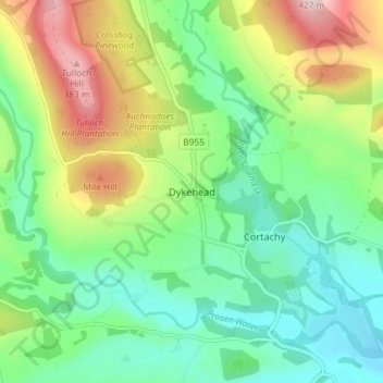
Name: Dykehead topographic map, elevation, terrain.
Location: Dykehead, Angus, Scotland, DD8 4EE, United Kingdom (56.70977 -3.02477 56.74977 -2.98477)
Average elevation: 202 m
Minimum elevation: 100 m
Maximum elevation: 404 m