
La Cuchilla topographic map
Interactive map
Click on the map to display elevation.
About this map
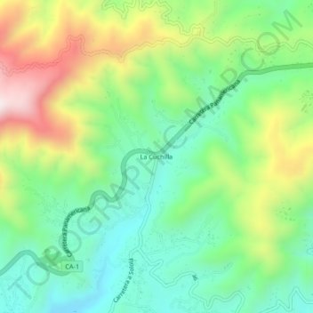
Name: La Cuchilla topographic map, elevation, terrain.
Location: La Cuchilla, Sololá, Guatemala (14.82238 -91.19252 14.86238 -91.15252)
Average elevation: 2,568 m
Minimum elevation: 2,320 m
Maximum elevation: 3,016 m