
L'Orignal topographic map
Interactive map
Click on the map to display elevation.
About this map
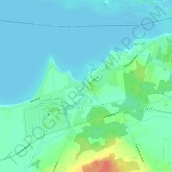
Name: L'Orignal topographic map, elevation, terrain.
Average elevation: 49 m
Minimum elevation: 38 m
Maximum elevation: 87 m
Other topographic maps
Click on a map to view its topography, its elevation and its terrain.
Vankleek Hill
Canada > Ontario > Comtés unis de Prescott et Russell > Champlain > Vankleek Hill
Vankleek Hill, Champlain, Comtés unis de Prescott et Russell, Est de l'Ontario, Ontario, K0B 1R0, Canada
Average elevation: 96 m