
Jaraicejo topographic map
Interactive map
Click on the map to display elevation.
About this map
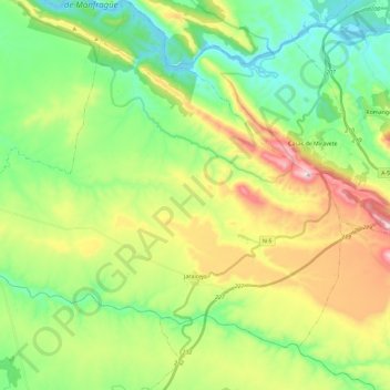
Name: Jaraicejo topographic map, elevation, terrain.
Location: Jaraicejo, Trujillo, Cáceres, Extremadura, 10380, España (39.63366 -5.95804 39.77416 -5.72587)
Average elevation: 443 m
Minimum elevation: 240 m
Maximum elevation: 825 m