Gangkhar Puensum topographic map
Interactive map
Click on the map to display elevation.
About this map
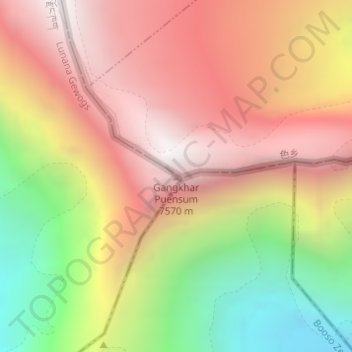
Name: Gangkhar Puensum topographic map, elevation, terrain.
Average elevation: 6,616 m
Minimum elevation: 5,489 m
Maximum elevation: 7,486 m

Click on the map to display elevation.
Name: Gangkhar Puensum topographic map, elevation, terrain.
Average elevation: 6,616 m
Minimum elevation: 5,489 m
Maximum elevation: 7,486 m