
Taft topographic map
Interactive map
Click on the map to display elevation.
About this map
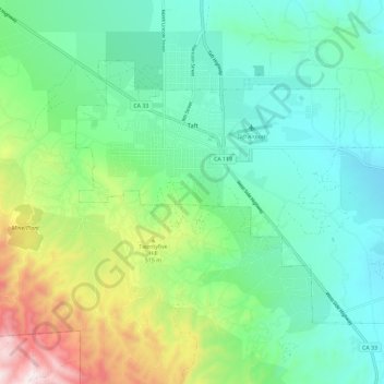
Name: Taft topographic map, elevation, terrain.
Average elevation: 370 m
Minimum elevation: 181 m
Maximum elevation: 878 m
Taft (formerly Moron, Moro, and Siding Number Two) is a city in the foothills at the extreme southwestern edge of the San Joaquin Valley, in Kern County, California. Taft is located 32 miles (51 km) west-southwest of Bakersfield, at an elevation of 955 feet (291 m). The population was 9,327 at the 2010 census. According to the United States Census Bureau, the city has a total area of 15.1 square miles (39.1 km2).