
Stone Lake topographic map
Interactive map
Click on the map to display elevation.
About this map
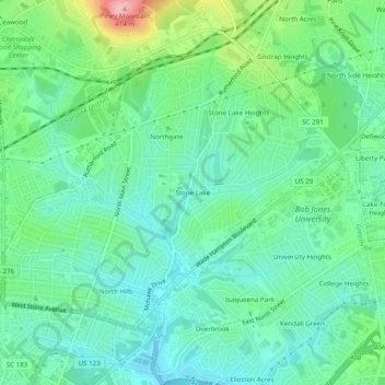
Name: Stone Lake topographic map, elevation, terrain.
Average elevation: 305 m
Minimum elevation: 265 m
Maximum elevation: 412 m
Other topographic maps
Click on a map to view its topography, its elevation and its terrain.
Glenwood Acres
United States > South Carolina > Greenville County > Greenville
Glenwood Acres, Greenville, Greenville County, South Carolina, 29614, United States
Average elevation: 305 m