
Mafinga Central topographic map
Interactive map
Click on the map to display elevation.
About this map
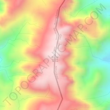
Name: Mafinga Central topographic map, elevation, terrain.
Location: Mafinga Central, Muchinga Province, Zambia (-9.95274 33.35231 -9.95264 33.35241)
Average elevation: 2,091 m
Minimum elevation: 1,738 m
Maximum elevation: 2,328 m
Other topographic maps
Click on a map to view its topography, its elevation and its terrain.