
Worcester topographic map
Interactive map
Click on the map to display elevation.
About this map
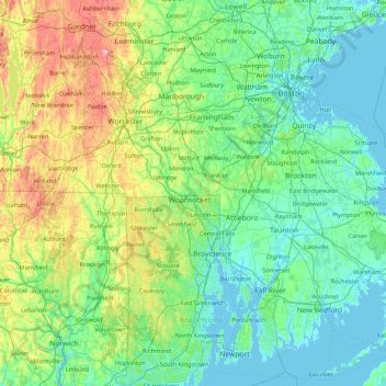
Name: Worcester topographic map, elevation, terrain.
Location: Worcester, Massachusetts, 02895, United States of America (41.38093 -72.13941 42.66093 -70.85941)
Average elevation: 95 m
Minimum elevation: -8 m
Maximum elevation: 584 m
Other topographic maps
Click on a map to view its topography, its elevation and its terrain.