
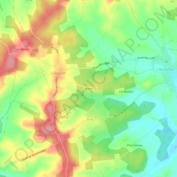
Rivière topographic map
Interactive map
Click on the map to display elevation.
About this map
Name: Rivière topographic map, elevation, terrain.
Average elevation: 142 m
Minimum elevation: 90 m
Maximum elevation: 206 m
Other topographic maps
Click on a map to view its topography, its elevation and its terrain.
Charmant
France > Nouvelle-Aquitaine > Charente > Boisné-la-Tude
Charmant, Boisné-la-Tude, Angoulême, Charente, Nouvelle-Aquitaine, France métropolitaine, 16320, France
Average elevation: 148 m
Chavenat
France > Nouvelle-Aquitaine > Charente > Boisné-la-Tude
Chavenat, Boisné-la-Tude, Angoulême, Charente, Nouvelle-Aquitaine, France métropolitaine, 16320, France
Average elevation: 138 m