
Roboré topographic map
Interactive map
Click on the map to display elevation.
About this map
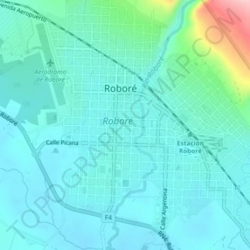
Name: Roboré topographic map, elevation, terrain.
Location: Roboré, Provincia Chiquitos, Santa Cruz, Bolivia (-18.35028 -59.76659 -18.32032 -59.73335)
Average elevation: 270 m
Minimum elevation: 240 m
Maximum elevation: 424 m