
Clear Lake topographic map
Interactive map
Click on the map to display elevation.
Clear Lake
Clear Lake is 19 mi (31 km) by 8 mi (13 km) at its widest point, with a surface area of 43,785 acres (17,719 ha) and a 1,155,000 acre⋅ft (1,425,000 dam3) capacity. Average depth is 27 ft (8.2 m), maximum is 60 ft (18 m), lake elevation is 1,329 ft (405 m), and average water temperature is 40 °F (4 °C) in winter and 76 °F (24 °C) in summer.
About this map
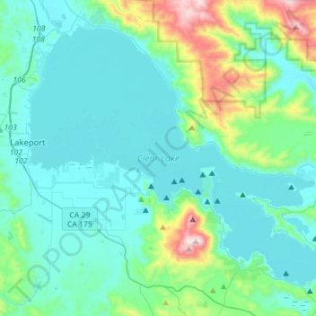
Name: Clear Lake topographic map, elevation, terrain.
Average elevation: 531 m
Minimum elevation: 389 m
Maximum elevation: 1,289 m