
Linggo topographic map
Interactive map
Click on the map to display elevation.
About this map
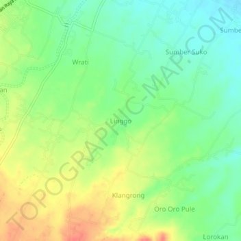
Name: Linggo topographic map, elevation, terrain.
Location: Linggo, Pasuruan, East Java, Indonesia (-7.75853 112.80023 -7.71853 112.84023)
Average elevation: 73 m
Minimum elevation: 46 m
Maximum elevation: 110 m