
Nakanojo topographic map
Interactive map
Click on the map to display elevation.
About this map
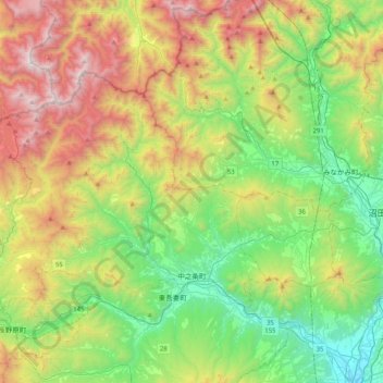
Name: Nakanojo topographic map, elevation, terrain.
Location: Nakanojo, Agatsuma County, Gunma Prefecture, Japan (36.55882 138.51403 36.76417 138.92069)
Average elevation: 882 m
Minimum elevation: 172 m
Maximum elevation: 2,159 m
Located in the northwestern portion of Gunma Prefecture, Nakanojō is surrounded by high peaks of over 1000 m in height, with the Agatsuma River passing through the center of town from west to east. The town has a mean elevation of 400 meters above sea level. The town's area is 83% mountains and forests (197 km2).