
Yeongam-gun topographic map
Interactive map
Click on the map to display elevation.
About this map
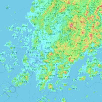
Name: Yeongam-gun topographic map, elevation, terrain.
Location: Yeongam-gun, Jeollanam-do, South Korea (34.16005 126.05704 35.44005 127.33704)
Average elevation: 72 m
Minimum elevation: -2 m
Maximum elevation: 1,145 m
Other topographic maps
Click on a map to view its topography, its elevation and its terrain.
Jangseong-gun
Jangseong-gun, Jeollanam-do, 57204, South Korea
Average elevation: 152 m