
Junglinster topographic map
Interactive map
Click on the map to display elevation.
About this map
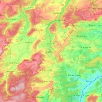
Name: Junglinster topographic map, elevation, terrain.
Location: Junglinster, Canton Grevenmacher, Luxembourg (49.67505 6.16700 49.74972 6.33284)
Average elevation: 333 m
Minimum elevation: 229 m
Maximum elevation: 444 m