
Uebersyren topographic map
Interactive map
Click on the map to display elevation.
About this map
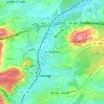
Name: Uebersyren topographic map, elevation, terrain.
Location: Uebersyren, Canton Luxembourg, 5380, Luxembourg (49.61184 6.25702 49.65184 6.29702)
Average elevation: 276 m
Minimum elevation: 238 m
Maximum elevation: 373 m