
Sirkantapuram topographic map
Interactive map
Click on the map to display elevation.
About this map
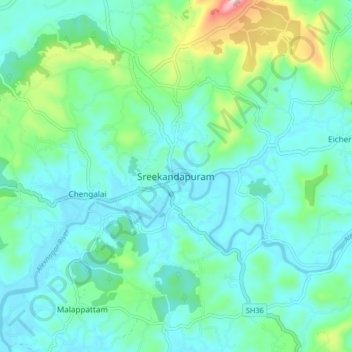
Name: Sirkantapuram topographic map, elevation, terrain.
Location: Sirkantapuram, Kannur district, Kerala, 670631, India (12.02722 75.49046 12.06722 75.53046)
Average elevation: 48 m
Minimum elevation: 4 m
Maximum elevation: 163 m