Kota Bharu topographic map
Interactive map
Click on the map to display elevation.
About this map
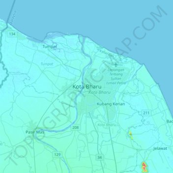
Name: Kota Bharu topographic map, elevation, terrain.
Location: Kota Bharu, Kelantan, 15000, Malaysia (5.96584 102.07998 6.28584 102.39998)
Average elevation: 6 m
Minimum elevation: -2 m
Maximum elevation: 184 m
Other topographic maps
Click on a map to view its topography, its elevation and its terrain.
Kampung Kok Pasir
Malaysia > Kelantan > Kota Bharu
Kampung Kok Pasir, Kota Bharu, Kelantan, 15400, Malaysia
Average elevation: 8 m
Kampung Pulau Gajah
Malaysia > Kelantan > Kota Bharu
Kampung Pulau Gajah, Kota Bharu, Kelantan, 16100, Malaysia
Average elevation: 6 m
Sungai Lubuk Mulong
Malaysia > Kelantan > Kota Bharu
Sungai Lubuk Mulong, Bunut Payong, Kota Bharu, Kelantan, 15150, Malaysia
Average elevation: 10 m