
Subotica topographic map
Interactive map
Click on the map to display elevation.
About this map
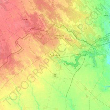
Name: Subotica topographic map, elevation, terrain.
Average elevation: 115 m
Minimum elevation: 87 m
Maximum elevation: 140 m
Subotica has a warm-summer humid continental climate (Dfb) that is uncommon in Serbia except at higher elevations,
Other topographic maps
Click on a map to view its topography, its elevation and its terrain.
City of Subotica
Serbia > Vojvodina > North Backa Administrative District
City of Subotica, North Backa Administrative District, Vojvodina, Serbia
Average elevation: 111 m