
Sawtry topographic map
Interactive map
Click on the map to display elevation.
About this map
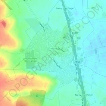
Name: Sawtry topographic map, elevation, terrain.
Average elevation: 18 m
Minimum elevation: 2 m
Maximum elevation: 54 m
Other topographic maps
Click on a map to view its topography, its elevation and its terrain.
Sawtry
United Kingdom > England > Sawtry
Sawtry, Cambridgeshire, East of England, England, PE28 5TG, United Kingdom
Average elevation: 22 m