
Culcheth topographic map
Interactive map
Click on the map to display elevation.
About this map
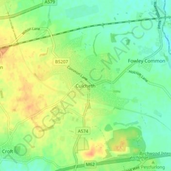
Name: Culcheth topographic map, elevation, terrain.
Location: Culcheth, Warrington, England, WA3 4EE, United Kingdom (53.43193 -2.54254 53.47193 -2.50254)
Average elevation: 28 m
Minimum elevation: 13 m
Maximum elevation: 46 m
Other topographic maps
Click on a map to view its topography, its elevation and its terrain.
Sankey Brook
United Kingdom > England > Warrington > Warrington
Sankey Brook, Great Sankey, Warrington, England, United Kingdom
Average elevation: 12 m
Burtonwood
United Kingdom > England > Warrington > Warrington
Burtonwood, Warrington, England, WA5 4NS, United Kingdom
Average elevation: 26 m