
Hohlichtgletscher topographic map
Interactive map
Click on the map to display elevation.
About this map
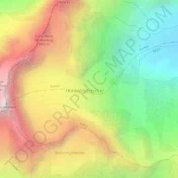
Name: Hohlichtgletscher topographic map, elevation, terrain.
Average elevation: 3,194 m
Minimum elevation: 2,343 m
Maximum elevation: 4,182 m
Other topographic maps
Click on a map to view its topography, its elevation and its terrain.
Mominggletscher
Mominggletscher, Firngrat, Randa, Visp, Wallis, 3928, Schweiz
Average elevation: 3,062 m