
Paola topographic map
Interactive map
Click on the map to display elevation.
About this map
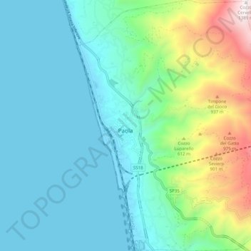
Name: Paola topographic map, elevation, terrain.
Location: Paola, Cosenza, Calabria, Italia (39.32353 16.02039 39.39923 16.09840)
Average elevation: 295 m
Minimum elevation: -1 m
Maximum elevation: 1,377 m
Other topographic maps
Click on a map to view its topography, its elevation and its terrain.