
Araku Valley topographic map
Interactive map
Click on the map to display elevation.
Araku Valley
Araku is located in the western Ghats about 114 kilometres (71 mi) from Visakhapatnam, close to the Odisha state border. The Anantagiri and Sunkarimetta Reserved Forest, which are part of Araku Valley, are rich in biodiversity and are mined for bauxite. Galikonda hill rising to a height of 5,000 feet (1,500 m) is amongst the highest peaks in Andhra Pradesh. The average rainfall is 1,700 millimetres (67 in), the bulk of which is received during June–October. The altitude is about 1300 m above the sea level. The valley spreads around 36km.
About this map
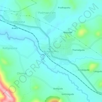
Name: Araku Valley topographic map, elevation, terrain.
Average elevation: 950 m
Minimum elevation: 900 m
Maximum elevation: 1,183 m
Other topographic maps
Click on a map to view its topography, its elevation and its terrain.