
Sint-Ulriks-Kapelle topographic map
Interactive map
Click on the map to display elevation.
About this map
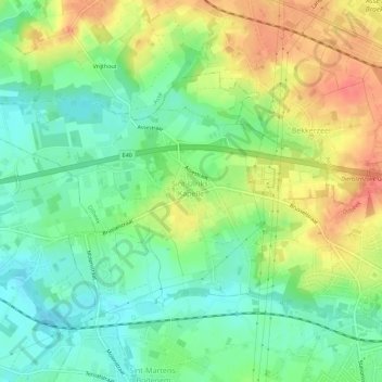
Name: Sint-Ulriks-Kapelle topographic map, elevation, terrain.
Average elevation: 50 m
Minimum elevation: 22 m
Maximum elevation: 86 m
Other topographic maps
Click on a map to view its topography, its elevation and its terrain.
Schepdaal
België > Vlaanderen > Dilbeek > Schepdaal
Schepdaal, Dilbeek, Vlaams-Brabant, Vlaanderen, 1703, België
Average elevation: 57 m